The day I read the BAS satellite papers, I spent a long time staring at a zoomed satellite image.
In 2018, a British Antarctic Survey, BAS, research team marked 11 new emperor penguin breeding sites on satellite images. Nobody had visited these places. Some were deep in sea ice where people rarely go; some lay beyond wind-lashed channels that helicopters could not cross.
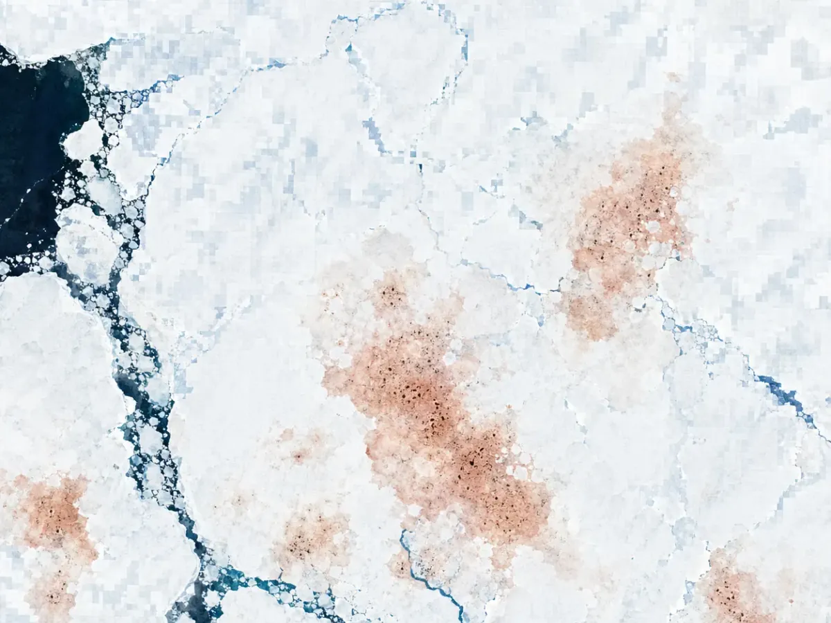
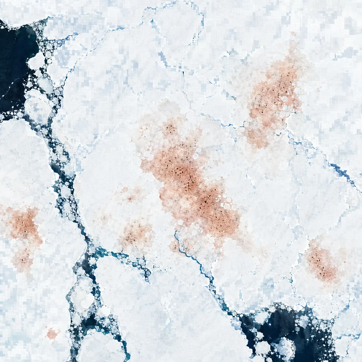
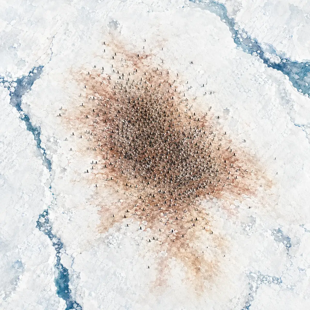
What found them were images from Sentinel-2 and Worldview-3 satellites, and the not-quite-brown, not-quite-tan patches on those images.
That was penguin guano. Brownish, left on white ice, visible to satellites 700 kilometers away.
A brown map inside pixels
For a satellite to find penguins from space, it first has to find what penguins leave behind. Penguins do not raise their hands in satellite images, but their guano does.
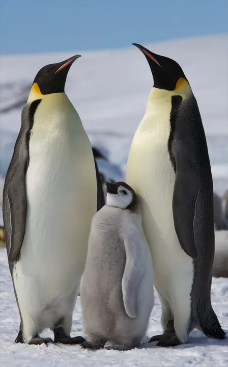
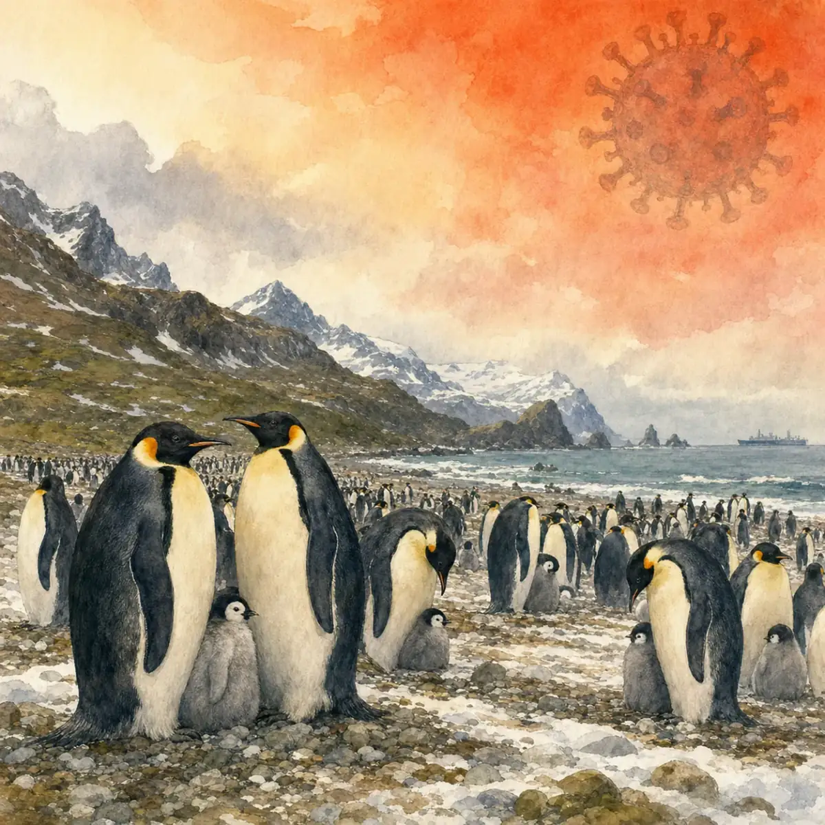
Emperor penguins breed during the Antarctic winter. They crowd onto sea ice, thousands or even tens of thousands standing on the same patch, staying out of the water for two months while taking turns holding eggs on their feet. Over time, large amounts of guano build up on the ice. Sun, freeze-thaw cycles, and compression leave broad brownish stains.
White ice, brown stain: the contrast is high for satellites. That observation made the whole remote-sensing method possible.
BAS researchers Peter Fretwell and Phil Trathan first proposed this method in a 2009 Global Ecology and Biogeography paper using the Landsat-7 satellite, with resolution around 30 meters. It could find the outline of colonies, but confirming size was still hard.
By the 2018 Antarctic Science paper, they had switched to Sentinel-2, with 10-meter resolution, and Worldview-3, with about 0.3-meter resolution. The edges of guano stains became much clearer. Automated classification algorithms could screen images in batches, and then researchers could verify candidates from the ground or air.
That is how the 11 new breeding sites surfaced. Several were deep inside sea-ice maps, with no coordinates and no names.
Different food, different color
One detail makes guano useful for satellites: its color changes with diet.
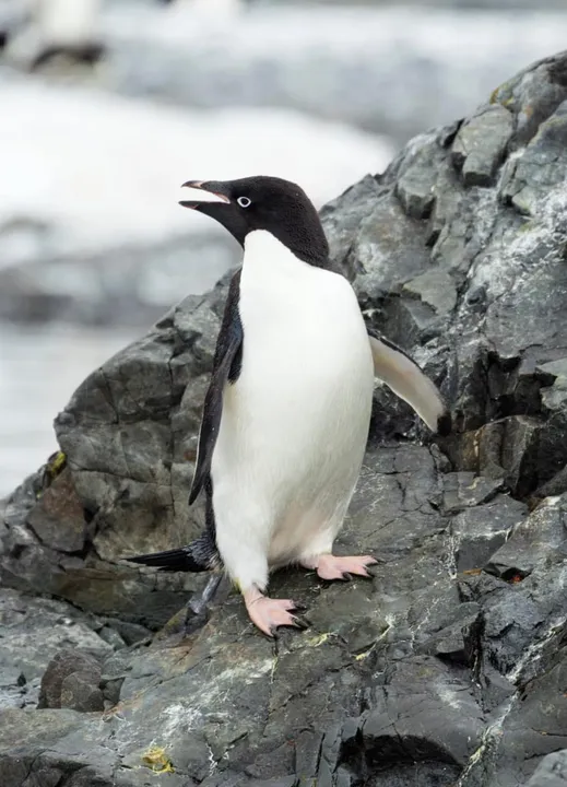
Adelie penguins, Pygoscelis adeliae, mainly eat krill, so their guano is pinkish because astaxanthin from krill leaves pigment after metabolism. Emperor penguins, Aptenodytes forsteri, eat fish and squid, so their guano tends toward brown and tan, quite different from Adelie guano.
That difference lets satellites distinguish between two penguin species.
Color classification in satellite images depends on the spectral reflectance of pixels. Diet-driven guano color differences correspond to different spectral features in the image. Researchers can use color to help infer which penguin species is present, without relying on other clues.
What they eat, what they leave behind: both get recorded by satellites.
That chain of inference is the foundation of the whole method.
From 30 meters to 0.3 meters
The Landsat satellites have a resolution of about 30 meters, meaning one pixel covers the area of a small parking lot. That precision can locate guano patches, but it is hard to count heads.
Sentinel-2 shrinks pixels to 10 meters, so patch boundaries become much clearer. Worldview-3 and other Maxar commercial satellites push resolution down to 0.3 meters; at that point, the outlines of individual penguins or small groups begin to be visible.
Each of the three resolution layers has its own job. The 30-meter layer screens all of Antarctica, broad but imprecise. The 10-meter layer confirms colony boundaries, balancing coverage and detail. The 0.3-meter layer approaches aerial-photo precision and is used to verify colony density or estimate individuals, but it cannot cover the whole Antarctic continent.
Stacking all three layers is what lets researchers move from pixels to head counts. Each layer does the thing it is best at.
Find the map, check the field
Satellite imagery is only the starting point. Finding a colored patch is just the first step.
Once researchers have a list of suspected guano stains, they still have to verify them. Antarctic field checks are expensive, and some breeding sites cannot be reached during the short weather windows at all. BAS prioritizes low helicopter or fixed-wing flights to confirm sites with aerial photography. Places that cannot be flown are checked by comparing satellite images across multiple time points.
In a 2012 PLoS ONE paper, Fretwell and Trathan used satellite methods to estimate the global emperor penguin population at about 595,000 birds, spread across 46 breeding sites.
With the 11 new sites added in 2018, the total number of breeding sites rose to 54, while population sizes at individual new sites were still being assessed.
In 2024, the research team again updated the distribution map using Sentinel-2 and the latest Maxar imagery. Around some old breeding sites, sea-ice conditions had changed clearly over the past decade. Guano patches at several sites had shrunk, and some had disappeared entirely.
Disappearance does not necessarily mean all the penguins died. A colony may have moved to nearby, more stable ice, and satellites may not yet have found the new position.
The emperor penguin’s sea-ice account
Among living penguins, emperor penguins depend most strongly on sea ice. Both breeding and feeding are tied to stable ice.
They cannot breed on rocky shores the way Adelie or chinstrap penguins can. They need stable, thick sea ice as an incubation platform. If sea ice breaks up early in the middle of the breeding season, eggs and chicks that have not grown waterproof feathers fall straight into the sea.
Recent satellite monitoring shows that the duration of sea-ice cover around some breeding sites is shortening. Those numbers feed directly into conservation assessments.
In 2023, BirdLife International uplisted the emperor penguin to Vulnerable. Satellite images and population estimates were an important part of that assessment.
Using guano to find penguins is necessary because there is no better option. Antarctica is too large, the winter window too short, and walking in to look is a luxury.
What satellites can do is let researchers comb Antarctica from an office, mark unnamed stains one by one, and then work out how to confirm what they are.
The satellites are still running, and the map is not finished
ESA’s Sentinel-2 satellites are still regularly scanning Antarctic sea ice, with images updated every few days. The BAS team continues to use this data to monitor changes at known breeding sites and to screen for new ones.
The 54 known breeding sites are not the final answer. Researchers say this themselves.
Some breeding sites are often hidden by cloud. Some have no usable light during the polar night. Satellites cannot see those either. Deeper sea-ice regions and more remote places may still hold guano stains that have not been found.
From pixels to stomachs, from 30 meters to 0.3 meters, this observation chain gets a little closer every few years. But the Antarctic sea-ice map is also changing at the same time. Penguins on the ground move with it, and satellites keep following.
Whether today’s 54 sites are close to complete or only the known part is something I am still watching in the next batch of images.
FAQ
Can satellites really see penguins from space?
They usually detect guano stains first, not individual birds. Large colonies leave brown patches on white sea ice that satellites can classify.
What did the 2018 satellite study find?
British Antarctic Survey researchers used Sentinel-2 and Worldview-3 imagery to mark 11 new emperor penguin breeding sites, bringing the known total to 54.
Why does guano color help identify species?
Adelie penguins eat krill and leave pinkish guano, while emperor penguins eat fish and squid and leave browner guano; that difference appears in spectral signatures.